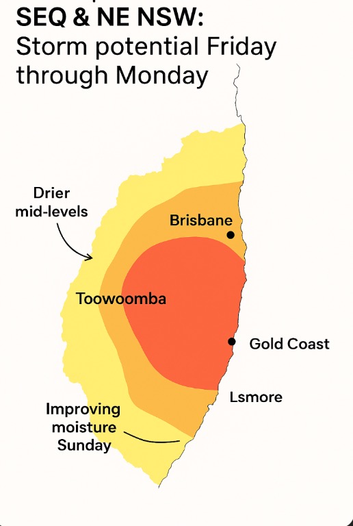
🌦️ SEQ & NE NSW Weather Outlook – Friday to Sunday
So it doesn’t appear to be all doom and gloom, there is hope on the horizon, albeit not a lot of showers or rain but there is the possibility of some good news.
After running through the modelling, here’s the latest wrap from the models and soundings up to Sunday. Things are slowly shifting, but it’s not the clean setup many of us were hoping for yet.
Friday:
Both the GFS and EC models show a fair bit of disagreement.
GFS keeps a strong dry slot sitting through the mid-levels, which really limits storm potential. EC tries to hang onto a little more boundary-layer moisture, hinting at a weak shower or rumble out west near Toowoomba or the Downs late in the day.
Overall though, expect mostly dry, warm conditions with patchy high cloud. Any activity will likely fizzle out before reaching the coast.
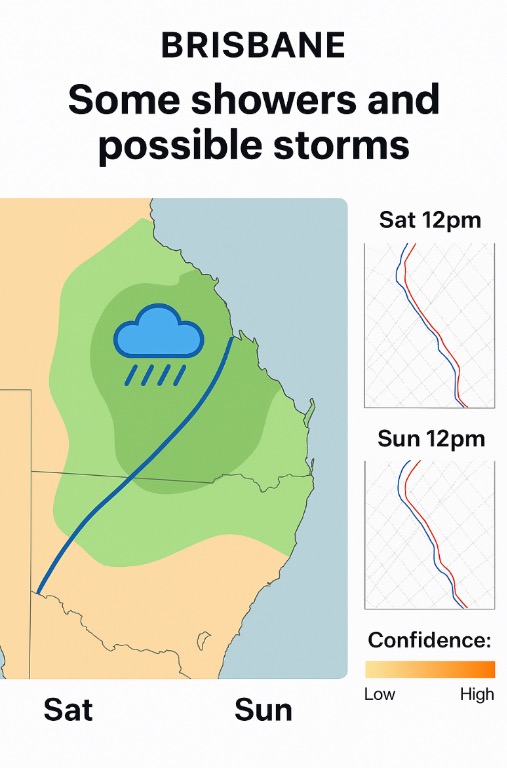
Saturday:
Low-level moisture improves a touch but instability stays capped. CAPE values stay below 200 J/kg on the latest soundings, so anything that pops will be shallow.
We might see some cumulus bubbling over the ranges during the afternoon, but the dry upper air should choke most updrafts.
If anything does develop, expect high-based cells with gusty outflow rather than useful rain. Dew points edge up south of the border which could help Sunday’s setup.
Sunday:
This is the first day showing real potential for change. Onshore flow deepens and both EC and GFS start agreeing on a more humid profile.
CAPE lifts into the 100–400 J/kg range with PWAT near 45–50 mm – enough for scattered showers and some embedded thunder.
It doesn’t look like a severe day, more a thundery rainband type setup. Toowoomba, Brisbane and down into the Northern Rivers stand the best chance.
If upper winds strengthen a bit, we could see a few short-lived but punchy cells during the afternoon.
Bottom line:
Friday mostly dry. Saturday might throw up a few dry or high-based showers inland. Sunday finally looks wetter and more humid with a better shot at rain and isolated thunder. Not a big severe risk yet, but a step in the right direction after the dry run we’ve had.
Below are three graphs from this morning data highlighting the potential of showers or possible storms from Friday to Sunday and should mention showers should linger into Monday. Please note this is my interpretation and is not an accurate forecast, but it is what I am seeing and my opinion. Things can and do change quickly so the best thing is to constantly keep an ear and eye out for any warnings if fires or storms become a hazard or severe.