Just finished posting and one of the cells has been labelled a VERY DANGEROUS CELL 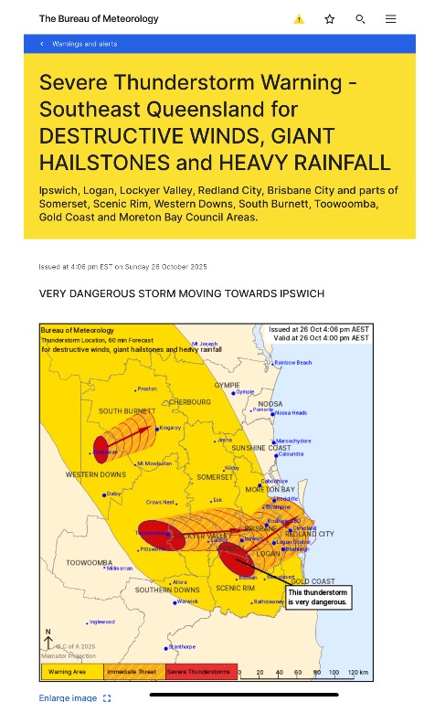 The Bureau of Meteorology warns that, at 4:00 pm, a VERY DANGEROUS THUNDERSTORM likely to produce damaging, locally destructive winds, large, possibly giant hailstones and heavy rainfall that may lead to flash flooding was detected near Harrisville, Peak Crossing and Rosewood. This thunderstorm is moving towards the northeast. It is forecast to affect Brisbane CBD, Ipswich, Beenleigh and Logan Central by 4:30 pm and Cleveland, Strathpine and Redcliffe by 5:00 pm. Other severe thunderstorms likely to produce damaging winds, large hailstones and heavy rainfall that may lead to flash flooding were detected near Toowoomba and the area south of Toowoomba. These thunderstorms are moving towards the east to northeast. They are forecast to affect Laidley, Gatton and the area north of Toowoomba by 4:30 pm and the area south of Esk, the area west of Kingaroy and the area northwest of Kingaroy by 5:00 pm.
|


|
|
Font Color
Font Size
|
|
Important Information:
The Weather Forum uses cookies. By continuing to browse this site, you are agreeing to our use of cookies.
More Details
Close
