Today’s environment across SE QLD and NE NSW remains conditional but potentially active, with several competing factors influencing storm development.
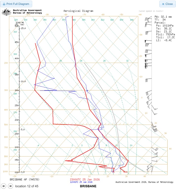
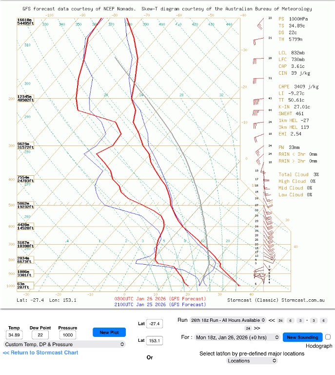
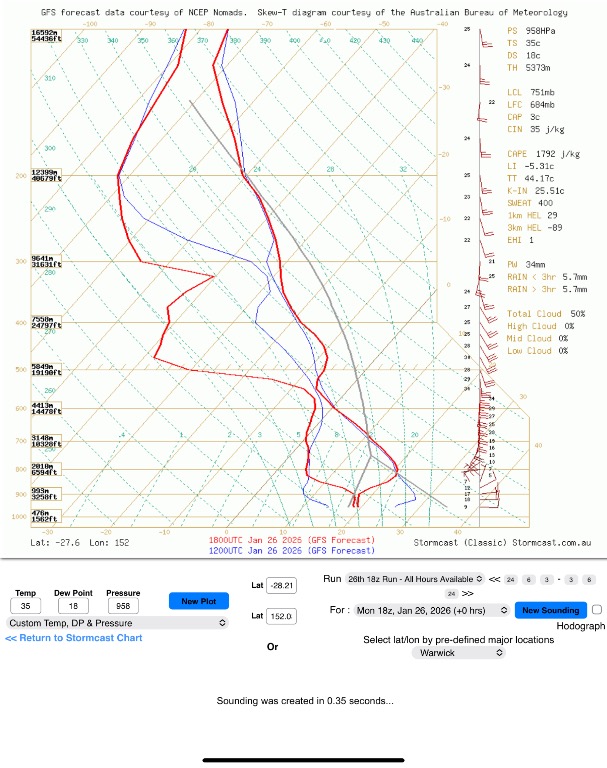
Atmospheric soundings (Brisbane observed and GFS guidance for Brisbane and Toowoomba) indicate:
Strong instability remains in place with CAPE generally 2500–3500 J/kg
Lifted Index values near –8 to –9
Total Totals around 50–52, slightly higher than yesterday
Cold mid-level temperatures near –35°C, supporting strong updraft potential
Deep-layer shear sufficient for organised multicells and isolated supercells
However, there are also notable limiting factors:
Dry air present through the mid-levels (700–500 mb)
Moderate convective inhibition (~30–40 J/kg)
Moisture depth remains somewhat shallow, particularly near the coast
This means storm initiation is not guaranteed and will likely depend on mesoscale triggers rather than large-scale forcing.
The main mechanism to monitor this afternoon is the NE sea breeze, which may:
Increase low-level moisture
Lower convective inhibition
Enhance convergence along inland-moving boundaries
Should this occur, storms that develop may intensify rapidly due to the strongly unstable and sheared environment.
If convection initiates successfully, hazards may include:
Damaging to locally destructive wind gusts
Large hail
Very heavy rainfall, particularly given slower storm motions
The highest risk remains inland SE QLD and NE NSW, with Brisbane and coastal areas more likely to see showers or embedded thunderstorms unless boundary interactions become favourable later in the day.
Overall, this is a low-coverage but high-impact setup, where storm development is uncertain, but any storm that forms could quickly become severe.
To simply put it today is a tricky setup.
There is plenty of energy in the atmosphere, and conditions are capable of producing strong to severe storms — but storms are not guaranteed to form.
The positives:
Very hot surface temperatures
High instability
Cold air aloft
Strong winds higher in the atmosphere
Total Totals slightly higher than yesterday
The negatives:
Dry air above the surface
A moderate cap that needs to be broken
Limited large-scale forcing
Because of this, storms will rely heavily on local triggers, especially the NE sea breeze pushing inland this afternoon.
If the sea breeze brings enough moisture and convergence, storms could develop quickly and become strong, with risks including damaging winds, hail, and heavy rainfall.
If this does not occur, many areas may only see showers or miss out entirely.
In short:
Storm coverage is uncertain, but any storm that does form could pack a punch.
Below are the soundings for Brisbane from BoM then followed by Brisbane GFS, Toowoomba and Warwick GFS.

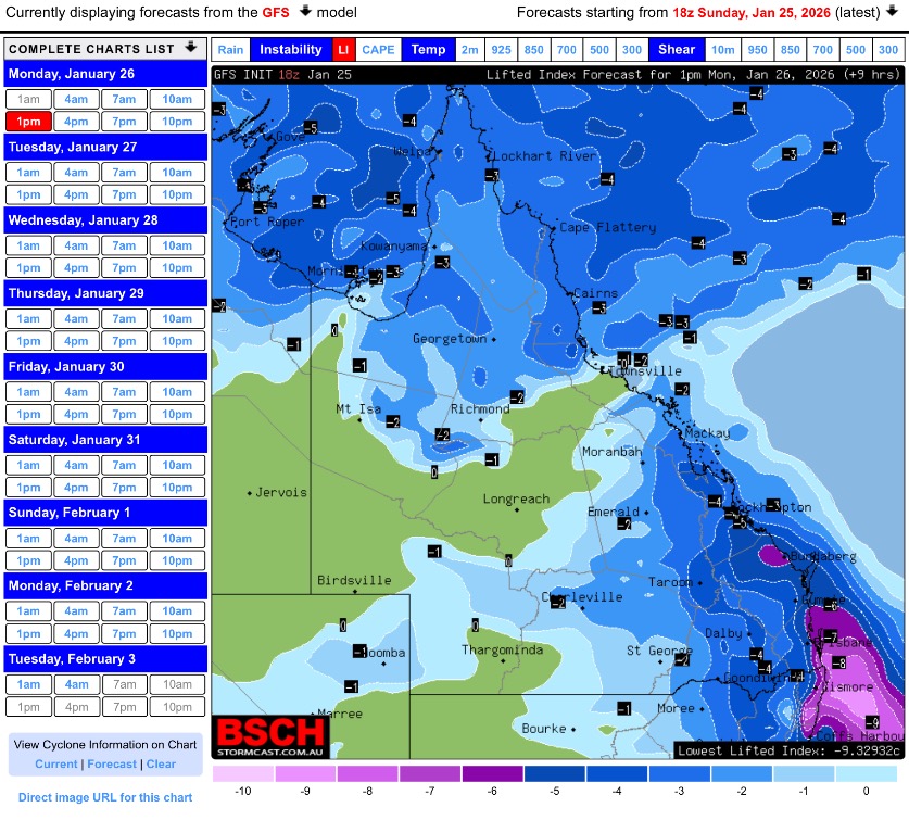
Below is the Li for the regions within this thread .
So the best thing to do is just keep an eye on the sky and if storms are able to build and become severe listen for any warnings. A tricky setup once again.
