Weather Forum
»
Australia Weather
»
SEQ and NE NSW
»
SE QLD and NE NSW - Day to day Weather 2024
Rank: Advanced Member
Groups: Registered, Administrators Joined: 21/08/2019(UTC) Posts: 941  Location: Brisbane Northside Thanks: 1198 times
Was thanked: 1136 time(s) in 674 post(s)
|
Some very decent showers this morning. A few bands crossings the Southern part Queensland Coastal areas from the Southeast and sweeping up to the Northwest. Cooler weather coming up over the weekend and into next with average temperatures now predicted.  BoM have a 50% chance of another La Niña event developing as the ocean temperatures are rapidly dropping from 50 -150 feet below the surface. As upwelling continues the surface temperature will likewise drop. 50% is high for this early on the development stage for BoM . It is almost an assured thing. Although NOAA had predicted this almost 3 months ago with the anomalies they noted in some areas that were rapidly cooling in the Pacific Ocean and in pockets around Australia. . Edited by user Thursday, 16 May 2024 7:53:29 AM(UTC)
| Reason: Not specified |
Colin Maitland. |
 1 user thanked Colmait for this useful post.
|
|
|
|
Rank: Advanced Member
Groups: Registered, Administrators Joined: 21/08/2019(UTC) Posts: 941 Location: Brisbane Northside Thanks: 1198 times
Was thanked: 1136 time(s) in 674 post(s)
|
Very nice brisk mornings recently.
Sunday was just a perfect day weather wise. The sky was a beautiful shade of blue and clear with just enough heat when you were out of the wind. The wind chill kept temperatures down a few degrees from the actual recorded temperature and we should expect much the same over the next couple of days before a bit of cloud rolls back in.
Enjoy!!
Cheers
Colin |
Colin Maitland. |
1 user thanked Colmait for this useful post.
|
|
|
|
Rank: Advanced Member
Groups: Registered
Joined: 13/03/2024(UTC) Posts: 161 Location: South East Qld Thanks: 457 times
Was thanked: 152 time(s) in 149 post(s)
|
I haven't posted for a few days as I have been too busy enjoying this beautiful weather  I agree Colmait that Sunday was a perfect day weather wise. It was such lovely weather on the weekend and gave us a chance to catch up on some much needed yard work now the yard is drying out again after those (what seemed like) months of wet weather. Yesterday was also absolutely perfect weather wise. It was a day off so we took a drive out to the Lockyer Valley and spent some time at a dam/lake out that way. The sky was so clear and blue and the mountains looked just magnificent against that blue sky. Sitting with our backs to the sun, soaking up its warmth without getting too hot and watching the amazing variety of water birds on the still and calm lake was a wonderful way to spend the afternoon. My idea of perfect weather. The nights and early mornings are definitely quite cool now and driving home this afternoon I noticed clouds are starting to pop up again. Looking at the BOM forecast for Brisbane for the next few days the highest expected maximum is 25°C and the lowest minimum is 12°C. Only one sunny day forecast (Thursday), with Wednesday and Friday having some clouds and showers are expected for Saturday.
|
1 user thanked Aussie Girl for this useful post.
|
|
|
|
Rank: Advanced Member
Groups: Registered, Administrators Joined: 21/08/2019(UTC) Posts: 941 Location: Brisbane Northside Thanks: 1198 times
Was thanked: 1136 time(s) in 674 post(s)
|
Hey that sounds great @ Aussie Girl, sounds relaxing. Our weather takes a little turn with a bit of a mixed variety of slightly warmer Min and Max temperatures due to cloudy days and nights trapping the heat. We also have the possibility of showers along the Coastal areas within this thread. Below is GFS’s take on the possible totals, although not a lot in it. This is due to the High’s down in the Tasman and Southern Ocean. A new high will form and then drift over Tasmania towards the Tasman Sea during the weekend, maintaining the current ridge over Queensland. This should allow a weak trough to combine with an upper level system to create unsettled weather in western Queensland from early to mid week.  |
Colin Maitland. |
1 user thanked Colmait for this useful post.
|
|
|
|
Rank: Advanced Member
Groups: Registered
Joined: 13/03/2024(UTC) Posts: 161 Location: South East Qld Thanks: 457 times
Was thanked: 152 time(s) in 149 post(s)
|
Well it looks like the first day of winter is going to be a wet one for SEQ. Saturday is forecast to have a very high chance of rain with Brisbane receiving up to 20mm.
The maximum temperatures forecast for early next week are in the very low twenties with minimums of between 10 and 12°C. Monday and Tuesday are forecast to be sunny so they are looking like being lovely early winter days with blue sunny skies and cooler temps.
|
1 user thanked Aussie Girl for this useful post.
|
|
|
|
Rank: Advanced Member
Groups: Registered
Joined: 13/03/2024(UTC) Posts: 161 Location: South East Qld Thanks: 457 times
Was thanked: 152 time(s) in 149 post(s)
|
Very thick fog this morning. Flights have been diverted from Brisbane Airport due to the heavy fog. 
|
1 user thanked Aussie Girl for this useful post.
|
|
|
|
Rank: Advanced Member
Groups: Registered, Administrators Joined: 21/08/2019(UTC) Posts: 941 Location: Brisbane Northside Thanks: 1198 times
Was thanked: 1136 time(s) in 674 post(s)
|
A thick fog blanketing over Brisbane again due to the moisture and humidity in the air. This was over our Suburb at 0615. 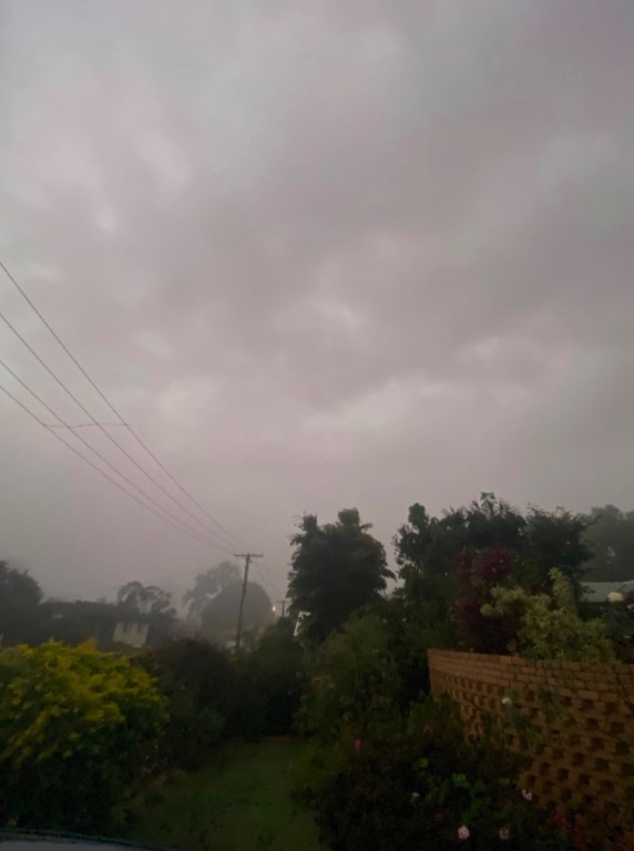  Rain has been on the forecast for most states of Australia with today, Saturday to be the heaviest. You can see the rain trough building to the West of Brisbane this morning on the radar. Then some colder weather to settle in for the next week. Edited by user Saturday, 1 June 2024 6:54:17 AM(UTC)
| Reason: Not specified |
Colin Maitland. |
1 user thanked Colmait for this useful post.
|
|
|
|
Rank: Advanced Member
Groups: Registered
Joined: 13/03/2024(UTC) Posts: 161 Location: South East Qld Thanks: 457 times
Was thanked: 152 time(s) in 149 post(s)
|
Interesting looking sky in those photos Colmait.
According to the BOM forecast for Brisbane there is a chance of fog again tomorrow morning. Then we should have a nice sunny day with a maximum temp of 23°C.
|
1 user thanked Aussie Girl for this useful post.
|
|
|
|
Rank: Advanced Member
Groups: Registered, Administrators Joined: 21/08/2019(UTC) Posts: 941 Location: Brisbane Northside Thanks: 1198 times
Was thanked: 1136 time(s) in 674 post(s)
|
Two coolish mornings in a row with both days, Tuesday and Wednesday dropping to single digits. This morning, Tuesday was 8°C with a feel like temperature of 6°C.
After the upper trough that is currently sitting over Southern Qld moves East, we should feel a burst of Westerly winds late Friday afternoon/ evening and into Saturday. With a top of 21°C predicted for Saturday you can guarantee the wind chill should make it feel like around 16-17°C.
Definitely enjoying this weather after the brutal summer we had.
Cheers
Colin |
Colin Maitland. |
1 user thanked Colmait for this useful post.
|
|
|
|
Rank: Advanced Member
Groups: Registered, Administrators Joined: 21/08/2019(UTC) Posts: 941 Location: Brisbane Northside Thanks: 1198 times
Was thanked: 1136 time(s) in 674 post(s)
|
It looks like the Westerly change will sweep through South East QLD a little earlier than my previous post. We should feel the winds earlier this morning rather than later tonight, and in turn we have a cooler day on the cards. The wind chill should make the apparent temperature feel a lot colder than the actual temperature.
Absolutely beautiful days though.
Cheers
Colin. |
Colin Maitland. |
1 user thanked Colmait for this useful post.
|
|
|
|
Rank: Advanced Member
Groups: Registered
Joined: 13/03/2024(UTC) Posts: 161 Location: South East Qld Thanks: 457 times
Was thanked: 152 time(s) in 149 post(s)
|
I agree Colmait, the days are absolutely beautiful at the moment.
Looking at the BOM forecast for the Brisbane area for the next week, it appears we will be having more of the same lovely weather through into next week. Sunny/mostly sunny days with maximum daytime temperatures between 21 and 23°C. The forecast minimums are between 8 and 10°C.
|
1 user thanked Aussie Girl for this useful post.
|
|
|
|
Rank: Advanced Member
Groups: Registered, Administrators Joined: 21/08/2019(UTC) Posts: 941 Location: Brisbane Northside Thanks: 1198 times
Was thanked: 1136 time(s) in 674 post(s)
|
There has been a fair bit of smoke haze around the Southeast as the Rural Fire Brigade does a bit of back burning on Wednesday, Thursday and it should continue into Friday. We received a text warning on Wednesday regarding the haze for anyone with respiratory problems to take precautions.
The high that has been sitting over Queensland should move East bringing some warmer weather on Friday and then a possibility of showers on Saturday and a slight chance on Sunday. The weekend should see some colder maximums before a bit of a mixed bag of weather next week.
The long range forecast by BoM is for warmer weather from July onwards. An 80% chance of warmer Maximums and Minimums for the rest of winter. I am still not totally convinced just yet on their predictions. BoM still haven’t been able to get their long range forecast correct lately. Once again NOAA and the European agencies have been doing a better job with their model runs and forecasts.
|
Colin Maitland. |
1 user thanked Colmait for this useful post.
|
|
|
|
Rank: Advanced Member
Groups: Registered, Administrators Joined: 21/08/2019(UTC) Posts: 941 Location: Brisbane Northside Thanks: 1198 times
Was thanked: 1136 time(s) in 674 post(s)
|
A few more above average temperatures expected over the next 5 days due to a persistent high over Queensland. Sunday will be the warmest as winds shift around to the Northeast and Northwest bringing very warm air with it. Temps should on Sunday peak around 26°- 27°C then drop back a little on Monday before a cooler change arrives on Tuesday.
A real mixed bag of weather once again with showers and sunshine, warm to hot temperatures for June/ July before settling back down. I think this could be the normalcy of this winter. Much the same happened in the USA during their winter.
Cheers
Colin |
Colin Maitland. |
1 user thanked Colmait for this useful post.
|
|
|
|
Rank: Advanced Member
Groups: Registered, Administrators Joined: 21/08/2019(UTC) Posts: 941 Location: Brisbane Northside Thanks: 1198 times
Was thanked: 1136 time(s) in 674 post(s)
|
A high atmospheric pressure is currently being observed across south-east Australia, including a preliminary new national record measured in Tasmania this morning. The weather station at Sheffield reported a pressure of 1044.6 hectopascals (hPa) at 10:30am, which if confirmed beats the previous Australian record of 1044.3hPa at Launceston on June 7, 1967. The potential record is slightly contentious due to changing observation frequencies and techniques between now and 1967. However, the high looks likely to peak again near 1044hPa early Saturday, providing another opportunity for a record before the system weakens from Sunday. The abnormal pressure is having a significant impact on the nation's weather, including extreme low overnight temperatures over south-east states and a lengthy stretch of showery days along the eastern seaboard. Currently where we live it is 18°C but the apparent or feel like temperature has now dipped down to 12.8°C. ( 2:30 pm Thursday 4 July) .  Edited by user Thursday, 4 July 2024 2:42:34 PM(UTC)
| Reason: Spelling |
Colin Maitland. |
1 user thanked Colmait for this useful post.
|
|
|
|
Rank: Advanced Member
Groups: Registered, Administrators Joined: 21/08/2019(UTC) Posts: 941 Location: Brisbane Northside Thanks: 1198 times
Was thanked: 1136 time(s) in 674 post(s)
|
A massive polar front should hit the Southern States of Australia from approximately the 12 July 2024 and work its way up into Queensland by Monday. All going well, we should see some good snowfalls associated with the system. Below is Meteye’s take on the event. At this stage it is peaking towards the end of the run on Wednesday so it will be interesting to see the next updated run as well.  |
Colin Maitland. |
1 user thanked Colmait for this useful post.
|
|
|
|
Rank: Advanced Member
Groups: Registered
Joined: 13/03/2024(UTC) Posts: 161 Location: South East Qld Thanks: 457 times
Was thanked: 152 time(s) in 149 post(s)
|
It certainly was interesting weather wise over the two weeks of the Queensland school holidays. During the first week it was hard to believe we were actually in winter with lovely warm days but the second week was a different story. Winter had definitely arrived. Cool and wet and almost miserable days.
Today is lovely and warm in the sun and the temperature during the last couple of nights has not been too cold. Friday is looking to be a lovely sunny day with a maximum temp of 24°C for the Brisbane area.
|
1 user thanked Aussie Girl for this useful post.
|
|
|
|
Rank: Advanced Member
Groups: Registered, Administrators Joined: 21/08/2019(UTC) Posts: 941 Location: Brisbane Northside Thanks: 1198 times
Was thanked: 1136 time(s) in 674 post(s)
|
BoM have now hoped on board and in the Queensland forecast they have given the Granite Belt as slight chance of snow flurries on Tuesday-Thursday. 16-18 July. As we get a bit closer we should get a better picture of how far North this Polar cold snap has made its way.  |
Colin Maitland. |
1 user thanked Colmait for this useful post.
|
|
|
|
Rank: Advanced Member
Groups: Registered, Administrators Joined: 21/08/2019(UTC) Posts: 941 Location: Brisbane Northside Thanks: 1198 times
Was thanked: 1136 time(s) in 674 post(s)
|
The cold air definitely hit a wide area with the wind chill bringing temperatures down quite considerably. Moisture was a big issue for snow, but still there were flurries from Tenterfield down throughout the Northern Tablelands. Queensland did not miss out completely as a snow flurry was captured at Spicers Lodge yesterday at Maryvale, a little NE of Warwick. 7 news reports is here . http://7news.com.au/news/snow-f...s-in-brisbane-c-15375640Snow has fallen on Queensland’s Scenic Rim and there were toboggan rides across the border in NSW on Tuesday too. The operators of Spicers Peak Lodge in Maryvale, 130km southwest of Brisbane, said white powder fell across the resort for the first time in almost a decade.  |
Colin Maitland. |
1 user thanked Colmait for this useful post.
|
|
|
|
Rank: Advanced Member
Groups: Registered, Administrators Joined: 21/08/2019(UTC) Posts: 941 Location: Brisbane Northside Thanks: 1198 times
Was thanked: 1136 time(s) in 674 post(s)
|
Another burst of cold Arctic air will make its way into the Southern States by Saturday/ Sunday and into Southern Queensland late Sunday afternoon/ Evening. Daytime temperatures at this stage for this part of the thread, should be around the average for this time of year, but the windchill will make it feel cooler. The minimum temperatures are where we will feel it the most. We should see most areas in the single digits or into the -0°C’s.
This is all due to the Sudden Stratospheric Warming, or SSW that happened a couple of weeks back over the Antarctic . The SSW will drive our weather pattern well into spring. So the warm temperatures that BoM had spoken about last Mach never really eventuated. Once again the overseas modelling systems handled the forecasts way better. I am not BoM bashing. I just feel, like many others that the weather patterns are rapidly changing and some of the older modelling systems are not keeping apace with it.
Stay warm.
|
Colin Maitland. |
1 user thanked Colmait for this useful post.
|
|
|
|
Rank: Advanced Member
Groups: Registered
Joined: 13/03/2024(UTC) Posts: 161 Location: South East Qld Thanks: 457 times
Was thanked: 152 time(s) in 149 post(s)
|
Originally Posted by: Colmait  Another burst of cold Arctic air will make its way into the Southern States by Saturday/ Sunday and into Southern Queensland late Sunday afternoon/ Evening. Daytime temperatures at this stage for this part of the thread, should be around the average for this time of year, but the windchill will make it feel cooler. The minimum temperatures are where we will feel it the most. We should see most areas in the single digits or into the -0°C’s.
Definitely feeling those minimum temperatures this week. The days are absolutely lovely though and I am loving looking out the window at the clear blue skies. It is actually nice and warm outside when you are not in the breeze. Perfect winter days. A different story a couple of weeks ago when it was overcast and windy. The kids had their sports day at school and it was such a cold and miserable day. Those kind of winter days make we want to go into hibernation! We should enjoy these lovely days while we can though. The smoke from the burn offs remind me that it wont be long and summer will be here. If our summer is anything like what the northern hemisphere summer is now then it will not be pleasant. The rural fire brigade is predicting a possible intense bushfire season in Queensland this year 
|
1 user thanked Aussie Girl for this useful post.
|
|
|
|
Weather Forum
»
Australia Weather
»
SEQ and NE NSW
»
SE QLD and NE NSW - Day to day Weather 2024
Forum Jump
You cannot post new topics in this forum.
You cannot reply to topics in this forum.
You cannot delete your posts in this forum.
You cannot edit your posts in this forum.
You cannot create polls in this forum.
You cannot vote in polls in this forum.
Important Information:
The Weather Forum uses cookies. By continuing to browse this site, you are agreeing to our use of cookies.
More Details
Close
